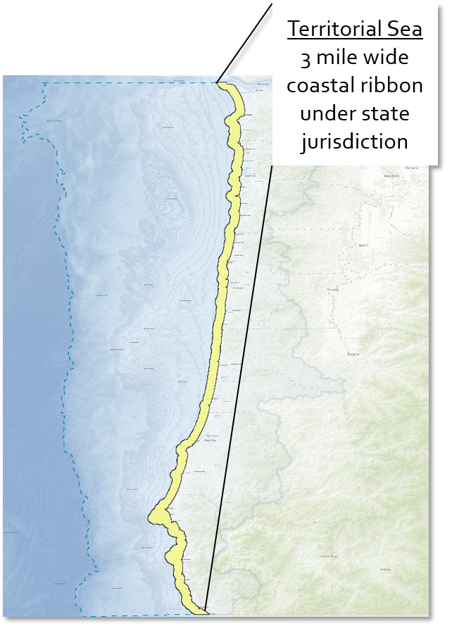
A Resource for Planning in the Oregon Territorial Sea

Oregon Ocean Information Oregon Ocean Information
  • Home
  • Ocean Policy

    Ocean Policy Advisory Council

    • About OPAC
    • OPAC Meetings

    Scientific and Technical Advisory Committee

    • About STAC
    • STAC Meetings

    Rock Habitats Site Planning

    • About Rocky Habitat Planning
    • Rocky Habitat Planning Meetings

    Ocean Acidification & Hypoxia

    • About the OAH Council
    • OAH Council Meetings
  • Management

    Goals & Planning

    • Oregon Territorial Sea Plan
    • Goal 19
    • Offshore Wind Roadmap

    Ocean Management Areas

    • Nearshore Habitats
    • Territorial Sea
    • Continental Shelf

    Rocky Habitat Areas

    • Marine Research Areas
    • Marine Gardens
    • Marine Conservation Areas
  • Resources

    Tools

    • OROWindMap
    • Oregon SeaSketch

    Data

    • West Coast Ocean Data Portal
    • NANOOS Visualization System

    Research

    • Oregon Ocean Science Trust
    • Oregon Marine Reserves System

    Resources

    • Document Library
    • Events Calendar
  • News & Links
    • News
    • Interesting Links
  1. You are here:  
  2. Home
  3. Management
  4. Management Areas
  5. Territorial Sea

Territorial Sea

Oregon has jurisdiction over the seabed and its resources out to three nautical miles and sometimes further if offshore islands or rocks provide a more seaward point for measurement. This three-mile ribbon of ocean, comprising about 1,000 square miles, is Oregon's ocean area covered by the Territorial Sea Plan.

Oregon's ocean area stretches approximately 360 miles from the mouth of the Columbia River to the California border and extends some 14 to 40 miles offshore. This area is part of and influenced by oceanographic and atmospheric forces that affect the entire Pacific Ocean. Effective policy and management of the ocean and Oregon's Coast requires an understanding of the setting and forces that affect this dynamic environment.

The area of the Territorial Sea is represented in yellow. The dotted blue line shows the extent of the Oregon Ocean.


Search

DCLD logo

The Oregon Department of Land Conservation and Development maintains this website.  Please contact the Marine Affairs Coordinator below for more information or with comments.  

Andy Lanier
Marine Affairs Coordinator
635 Capitol St. NE, Suite 150
Salem, OR 97301-2540
Andy.Lanier@dlcd.oregon.gov

Upcoming Meetings

22 May
STAC Meeting May 22nd, 2025
Date May 22, 2025 10:00 am - 12:00 pm

Partner Links

  • Ocean Shore State Recreation Area
  • Oregon Coast Trail
  • Oregon Marine Reserves
  • Oregon Nearshore Strategy
  • Oregon Owned Waterways
  • Oregon State Marine Board